

- Details
- Category: Municipalities
- Hits: 7208
Vinzons, officially the Municipality of Vinzons, is a 3rd class municipality in the province of Camarines Norte, Philippines. According to the 2015 census, it has a population of 43,485 people.
The Calaguas Islands are part of Vinzons.
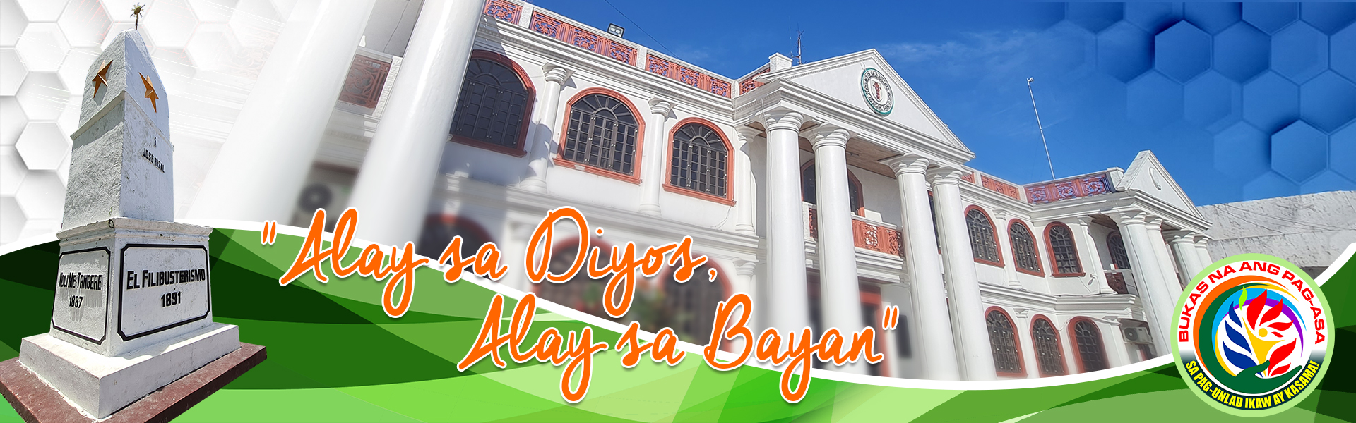
The very first recorded name of Vinzons was Tacboan and was later changed to Indan at which time the Mayor was Pedro Barbin. The town was then renamed "Vinzons" in honor of Wenceslao Q. Vinzons, then Governor of the province. He was the youngest delegate to the Philippine Constitutional Convention of 1935, and a guerrilla leader martyred by the Japanese during World War II.
History
The town was established in 1581 by the Franciscan Priests without a patron saint and without a church. In 1611, Fr. Juan de Losar, OFM built a church named after Saint Peter. Fr. Losar was the first Parish Priest of the church. In 1624, the whole town of Tacboan was relocated and it was called Indan where a new church was built with the same Patron Saint, St. Peter the Apostle. Vinzons is known for the religiosity of its inhabitants, contributing priests and nuns to the Catholic Church more than any other town in the province. Curiously, the town has always been known as the town of politicians, having had more provincial elective officials than in any other town in the province. There was a time, in fact, when all three candidates for governor hailed from Vinzons as when Dominador Asis, Fernando V. Pajarillo, and Wenceslao G. Vinzons, Jr. ran for governor in the elections of 1964. Before that, majority of the provincial governors came from Vinzons: Carlos Balce (1928-1931) Wenceslao Q. Vinzons (1937-1940), Carlos Ascutia (1944-1946), Regino Z. Guinto (1946-1947), Cayetano Vinzons (1958), Dominador Asis (1959-1963), Wenceslao G. Vinzons, Jr. (1964-1968), Fernando V. Pajarillo,(who died while in office). Education is likewise valued by the inhabitants in that every family would attempt to send their children to study in Manila despite the prohibitive costs of lodging and tuition. It is the only town where in a single year, four lawyers passed the Bar examinations in 1978: Oscar G. Raro, Fernando Saludes, Dominador Ferrer, Jr., and Joseph Balce. On the political side only one Mayor in this town has accomplished to finish the three (3) terms. he is Buding Segundo. Buding Segundo is actually Jose Tacalan Segundo, is also the only Municipal Mayor in this town who is actually from a rural Barangay, which is Barangay Sabang. Another prominent mayor who served for two terms is Cesar Asis Cereno, who pushed for massive agricultural development in the countryside, particularly seaweeds production, which uplifted the living conditions of constituents in most fishing villages and island barangays. Agnes Mago Diezmo Ang (2010-2016) is the first lady mayor in the municipality.
Barangays
Vinzons is politically subdivided into 19 barangays, listed here with their current Barangay Captains.
- Aguit-It - Pedro Alan De Panes
- Banocboc - Jumer Avellano
- Cagbalogo - Melchor Canaria
- Calangcawan Norte - Roberto Cada
- Calangcawan Sur - Ma. Theresa Oco
- Guinacutan - Henry Racelis
- Mangcayo - Erwie Ramos
- Mangcawayan - Boboy Era
- Manlucugan - Dario Nano
- Matango - Ramon A. Magana
- Napilihan - Remberto Rogacion
- Pinagtigasan - Gabriel Cereno III
- Barangay I (Poblacion)- Gracia Villafranca Moneda
- Barangay II (Poblacion) - Jonah Valeros
- Barangay III (Poblacion) - Neil A. Obusan
- Sabang - Jose T. Segundo "ABC President"
- Santo Domingo - Manuel Obusan
- Singi - Efren Villafranca
- Sula - Corazon Saenz
Demographics
| Population census of Vinzons | ||
|---|---|---|
| Year | Pop. | ±% p.a. |
| 1903 | 6,665 | — |
| 1918 | 9,072 | +2.08% |
| 1939 | 11,249 | +1.03% |
| 1948 | 14,455 | +2.83% |
| 1960 | 18,196 | +1.94% |
| 1970 | 22,804 | +2.28% |
| 1975 | 24,361 | +1.33% |
| 1980 | 26,158 | +1.43% |
| 1990 | 31,774 | +1.96% |
| 1995 | 33,182 | +0.82% |
| 2000 | 37,893 | +2.89% |
| 2007 | 39,653 | +0.63% |
| 2010 | 41,915 | +2.04% |
| 2015 | 43,485 | +0.70% |
| Source: Philippine Statistics Authority | ||
In the 2015 census, the population of Vinzons, Camarines Norte, was 43,485 people, with a density of 310 inhabitants per square kilometre or 800 inhabitants per square mile.
Local government
Municipal officials:
- Municipal Mayor: Dr. Eleanor Ferrer Segundo.
- Vice Mayor: Ligaya Heraldo
- Councilors:
- Alexis Bardon
- Raul Elep
- Biboy Valeros
- Edwin Pajarillo
- Augorio Guinto
- Joaquin Emmanuel G. Pimentel
- Ex Officio (Liga ng mga Barangay): Jose T. Segundo
Education
Public secondary schools:
- Vinzons Pilot High School (Main Campus)
- DQ Liwag National High School
- Matango National High School
- Sabang National High School
- E Quintela High School
- Sarah Jane Ferrer High School
Public elementary schools:
- Vinzons Pilot Elementary School (Main Campus)
- Mangcayo Elementary School
- Calangacawan Norte Elementary School
- Calangacawan Sur Elementary School
- P.Barbin Elementary School
- Guinacutan Elementary School
- Banocboc Elementary School
- Juanita Balon Elementary School
- Santo Domingo Elementary School
- Pinagtigasan Elementary School
- Magcawayan Elementary School
- Aguit-it Elementary School
- Sula Elementary School
- Sabang Elementary School
- Matango Elementary School
Private elementary schools:
- St Peter Kiddie School
- Vinzons Christian School
Churches
- St. Peter the Apostle Church - Fire destroyed the St. Peter the Apostle Church on 26 December 2012 at around 0130 hours which started from the old convent. The 400-year-old church was one of the oldest churches in Bicol and erected during the Spanish Colony in 1600.
- St. Paul The Apostle Quasi Parish in Sabang
- Our Lady of Peace & Good Voyage Parish in Calaguas
- Our Lady of Fatima Shrine in Mangcauayan
- Sto. Domingo in Sto. Domingo
- St. Augustine in Matango
SOURCE: www.wikipedia.com
- Details
- Category: Municipalities
- Hits: 6255
Talisay, officially the Municipality of Talisay, is a 4th class municipality in the province of Camarines Norte, Philippines. According to the 2015 census, it has a population of 25,841 people.
The fertile soil, gentle topography (averaging about 10 metres (33 ft) above sea-level) and suitable climate are the main reasons why agriculture is the economic backbone of the town. Rice and coconut farming are the major agricultural activities for most of the barangays and fishing is the second thriving industry particularly in the coastal barangays.
Talisayons have a deep concern for education. A family no matter how poor, sends their children to school. Talisay has a very long list of successful professionals in various fields such as medicine, law, engineering, architecture, education, law enforcement and military service, banking, business, sports, entertainment, marketing and many more. The incumbent mayor is Ronnie Magana and vice mayor Juancho Zantua Ramores.
Talisayons are fond of arts and music. The municipality holds singing and dance competitions throughout the year usually held at the public plaza.
History
History indicates that long before the coming of the Spaniards there are already existed a village in the place where the municipality now stands. The settlement was characterized by a few isolated nipa huts surrounded by rice paddles and kaingins. Its dwellers were a group of sturdy, freedom-loving people of the Malayan stock.
In the later part of the 16th century, a group of Spaniards from Naga believed that the early settlers to be headed by the Conquistador Juan de Salcedo, toured the place in search of gold. While they were resting beneath the cool shade of the trees that grew abundantly along the river banks, they saw some people around. With the aid of the hand movements the soldiers asked in Spanish what the name of the place was. The natives who did not understand the language thought that the strangers were interested in the name of the trees so they readily answered “Talisay”. The soldiers recorded the word in their logbook as the name of the place. Since then the village has been called Talisay.
When the Americans came to this part of Bicol Peninsula in 1901 Talisay was reverted to its barrio status because of its very limited population and its inability to support its own government. This time, however, it was made a part of Indan, now Vinzons. It was only in 1908 that Talisay regained its identity as a distinct municipality.
Barangay
Talisay is politically subdivided into 15 barangays.
- Binanuaan
- Caawigan
- Cahabaan
- Calintaan
- Del Carmen
- Gabon
- Itomang
- Poblacion
- San Francisco
- San Isidro
- San Jose
- San Nicolas
- Santa Cruz
- Santa Elena
- Santo Niño
Demographics
| Population census of Talisay | ||
|---|---|---|
| Year | Pop. | ±% p.a. |
| 1903 | 3,684 | — |
| 1918 | 5,222 | +2.35% |
| 1939 | 5,671 | +0.39% |
| 1948 | 6,843 | +2.11% |
| 1960 | 8,539 | +1.86% |
| 1970 | 12,042 | +3.49% |
| 1975 | 13,328 | +2.06% |
| 1980 | 13,869 | +0.80% |
| 1990 | 16,896 | +1.99% |
| 1995 | 17,841 | +1.02% |
| 2000 | 21,509 | +4.09% |
| 2007 | 22,942 | +0.89% |
| 2010 | 23,905 | +1.51% |
| 2015 | 25,841 | +1.49% |
| Source: Philippine Statistics Authority | ||
In the 2015 census, the population of Talisay, Camarines Norte, was 25,841 people, with a density of 840 inhabitants per square kilometre or 2,200 inhabitants per square mile.
SOURCE: Camarines Norte Museum Archived Shrine and Curation Division
www.wikipedia.com
- Details
- Category: Municipalities
- Hits: 6384
San Vicente, officially the Municipality of San Vicente, is a 5th class municipality in the province of Camarines Norte, Philippines. According to the 2015 census, it has a population of 10,396 people.
History
The municipality of San Vicente already was in existence even before the province of Camarines Norte became a separate and distinct province from Camarines Sur.
Prior to its creation 91 years ago, it was just a barrio of Talisay. The influx of people from other places led to its creation. It was named after St. Vincent Ferrer, the patron saint of the municipality.
Although, San Vicente was made a municipality way back in 1877, the progress it has attained through the years could hardly be noticed. Its transition from a sleepy to a live municipality has been very slow. Its development is very moderate.
Barangays
San Vicente is politically subdivided into 9 barangays.
- Asdum
- Cabanbanan
- Calabagas
- Fabrica
- Iraya Sur
- Man-Ogob
- Silangan
- Kanluran
- San Jose - formerly Iraya Norte
Demographics
| Population census of San Vicente | ||
|---|---|---|
| Year | Pop. | ±% p.a. |
| 1903 | 1,552 | — |
| 1918 | 1,802 | +1.00% |
| 1939 | 1,960 | +0.40% |
| 1948 | 2,811 | +4.09% |
| 1960 | 4,308 | +3.62% |
| 1970 | 5,914 | +3.22% |
| 1975 | 6,330 | +1.37% |
| 1980 | 6,577 | +0.77% |
| 1990 | 7,321 | +1.08% |
| 1995 | 8,220 | +2.19% |
| 2000 | 8,984 | +1.92% |
| 2007 | 9,615 | +0.94% |
| 2010 | 10,114 | +1.86% |
| 2015 | 10,396 | +0.52% |
| Source: Philippine Statistics Authority | ||
In the 2015 census, the population of San Vicente, Camarines Norte, was 10,396 people, with a density of 180 inhabitants per square kilometre or 470 inhabitants per square mile.
Attractions
The Mananap Falls is approximately 20-25 ft tall, tucked inside the thick forest and mountains. The water was ice cold there is a small raft tied which will lead you near the falls and a ladder to get to the top of the falls. There is a jumping point as well.
SOURCE: Camarines Norte Museum Archived Shrine and Curation Division
www.wikipedia.com
- Details
- Category: Municipalities
- Hits: 7674
Santa Elena, officially the Municipality of Santa Elena, is a 3rd class municipality in the province of Camarines Norte, Philippines. According to the 2015 census, it has a population of 40,786 people.
History
Sta. Elena before is known as "ILAYANG SANTOL", a small sitio of barrio Pulongguit-guit, municipality of Capalonga, province of Camarines Norte. Residents then were few and far from each other that in cases of emergency a tambuli is used.
The Japanese during the war and then Eastern Tayabas Bus Company played an important role in establishing the access road to the Bicol Region from Manila, now fully developed and known as the Maharlika Highway. Thus, people began residing along the road, converging on and developing it into the poblacion area.
Until in one of their council assemblies, Eladio Borrio suggested to name the sitio Sta. Elena at the same time making St. Helena, The Empress, their patron saint. The motion was duly seconded and was approved unanimously.
Through the concerted efforts of its local leaders, Sta. Elena became an independent barrio in 1948. This was followed by flurry of donations of lots for its development.
Sta. Elena became a municipality on June 29, 1969 by virtue of Republic act 5480 thru the initiative of the local residents, local officials and then Congressman Fernando V. Pajarillo.
A more recent development is the reacquisition of areas from the nearby town of Calauag, Quezon, involving a boundary dispute ruled in favor of Sta. Elena by the Supreme Court in GR-80796 with an area of 8,762 hectares, thus expanding the area and horizon of Sta. Elena for further development.
Barangays
Santa Elena is politically subdivided into 19 barangays.
- Basiad
- Bulala
- Maulawin 1
- Polungguitguit
- Rizal
- Salvacion
- San Lorenzo
- San Pedro 2
- San Vicente
- Santa Elena (Poblacion)
- Villa San Isidro
- Plaridel (Macahadok) 1
- Cabuluan 1
- Don Tomas (Morato) 1
- Guitol 1
- Kagtalaba 1
- Maulawin 1
- Patag Ibaba 1
- Patag Ilaya 1
- Tabugon 1
Notes:
- Barangay acquired recently from Calauag, Quezon, due to boundary realignment from Macahadok River to Tabugon Stream adjoining Quezon Canal in Barangay Tabansak, Calauag, Quezon.
- Former political dispute between Capalonga, Camarines Norte, and then Calauag, Quezon.
Demographics
| Population census of Santa Elena | ||
|---|---|---|
| Year | Pop. | ±% p.a. |
| 1970 | 8,608 | — |
| 1975 | 10,841 | +4.73% |
| 1980 | 13,092 | +3.84% |
| 1990 | 20,105 | +4.38% |
| 1995 | 33,955 | +10.32% |
| 2000 | 37,878 | +2.37% |
| 2007 | 40,300 | +0.86% |
| 2010 | 40,828 | +0.47% |
| 2015 | 40,786 | −0.02% |
| Source: Philippine Statistics Authority | ||
In the 2015 census, the population of Santa Elena, Camarines Norte, was 40,786 people, with a density of 200 inhabitants per square kilometre or 520 inhabitants per square mile.
SOURCE: Camarines Norte Museum Archived Shrine and Curation Division
www.wikipedia.com
- Details
- Category: Municipalities
- Hits: 5944
San Lorenzo Ruiz is a fifth class municipality in the province of Camarines Norte, Philippines. According to the 2015 census, it has a population of 14,063 people.
Formerly called Imelda, it was renamed on February 10, 1989 in honor of San Lorenzo Ruiz, the first Filipino saint venerated in the Roman Catholic Church, canonized on October 18, 1987.
History
In 1800-1896, the municipality was only a sitio. During the Spanish regime, it was a territorial part of Calasgasan, an independent municipality which was merged to Daet as one of its leading barrios after the American Occupation.
The seat of locality was a vast virgin forest during the Spanish time. A certain person in the name of Juan Aruljo of Guinobatan, Albay came to this place in the later part of 1890 and started clearing the forested area which was a sitio of Mampurog. The place was called Matacong which became a barrio in the year 1938 during the term of the late Mayor Santiago Carranceja of Daet.
In 1905, after clearing the area referred as Matacong Juan Aruljo, the first settler, sold the place to Victor Abaño. On March 1919 after a series of divisions and fusions, the province of Ambus Camarines was finally divided into two provinces – Camarines Norte and Camarines Sur, Daet became the capital of Camarines Norte. That time, Daet regained its barrios, the former territory of the municipality of Calasgasan of the Spanish days. In 1917, Victor Abaño sold the area of Matacong to Victor Racho. Later in 1938, the settlers and residents which grew in great number formed an organization called “Samahang Magsasaka” (Farmer’s Association). The organization represented and filed a resolution asking for the separation from Mampurog and creation of Matacong Council during the term of then Mayor Santiago Carranceja of Daet.
Again, Daet, lost its extensive territory in 1911 and 1948 when its most important barrios were created as the new municipalities of Basud and Mercedes respectively.
On November 8, 1970, upon the approval of Republic Act No. 6144 by the Congress of the Philippines, the municipality of Imelda was created. The barrios of Daculangbolo, Laniton, Langga, Maisog, Dagotdotan, Mampurog and Matacong were taken from Daet and the barrios of San Isodro, San Antonio, San Ramon, Salvacion and Manlimonsito from Basud to constitute the new municipality of Imelda. The municipality was named in honor of the Former First Lady of the country, Imelda Romualdez Marcos. Its first officials were elected in November 1971 and installed on January 1, 1972.
The seat of the new municipality was in barrio Matacong. The first municipal building was the residence of Hon. Paulino A. Belleza, a municipal councilman of the town. The residence was used as municipal office for the first three years. By the end of 1974, the municipal office was transferred to its permanent building at the present site. Lot was donated by the late Mr. Ernesto Velez.
The name of the municipality was changed from Imelda to SAN LORENZO RUIZ upon the approval of Republic Act 6708 on February 10, 1989 in honor of the first Filipino Saint who is also the patron of the parish.
Barangays
San Lorenzo Ruiz is politically subdivided into 12 barangays.
- Daculang Bolo
- Dagotdotan
- Langga
- Laniton
- Maisog
- Mampurog
- Manlimonsito
- Matacong (Poblacion)
- Salvacion
- San Antonio
- San Isidro
- San Ramon
Demographics
| Population census of San Lorenzo Ruiz |
||
|---|---|---|
| Year | Pop. | ±% p.a. |
| 1980 | 8,859 | — |
| 1990 | 9,286 | +0.47% |
| 1995 | 10,811 | +2.89% |
| 2000 | 11,678 | +1.67% |
| 2007 | 12,299 | +0.72% |
| 2010 | 12,592 | +0.86% |
| 2015 | 14,063 | +2.13% |
| Source: Philippine Statistics Authority | ||
In the 2015 census, the population of San Lorenzo Ruiz was 14,063 people, with a density of 120 inhabitants per square kilometre or 310 inhabitants per square mile.
Tourist Attractions
Waterfalls
- Nacali Falls - barangay Maisog
- Nakawa Falls - barangay Maisog
- Angelina Falls - San Isidro
- Nabangko Falls - barangay San Isidro
- Ibatan Falls - barangay San Isidro
Matacong Zipline
It's the longest zipline in the whole Bicol region located in barangay Matacong. The zipline is 750 meters long and is managed by the Local Government Unit (LGU) of San Lorenzo Ruiz. San Lorenzo Ruiz is aiming to become an Eco-Adventure town and the zipline is the start of their plans to add more facilities in the area to increase adventure sports like rappelling, water tubing, trekking, all terrain vehicle ride and many more.
Canyoning and River Trekking
The mampurog river have several meters of canyons and deep part of river that is suitable for canyoning activities. Canyoning is frequently done in remote and rugged settings and often requires navigational, route-finding and other wilderness travel skills.
On April 9, 2017 five explorers from Camarines Norte was given a permit by Nelson P. Delos Santos (Municipal Mayor) and Mr. Manuel Racho (Municipal Tourism Officer) to explore the Nacali Falls river and mampurog river as part of their dream to create a comprehensive list of waterfalls and different natural attractions in the province. One member of the team, Mr. Benjie S. Ilagan is a resident of Brgy. Mampurog and has visited Nacali Falls for more than five times. The other members of the team are as follows: Mr. Kimber Kaye S. Reyes as the team leader and navigator; Mr. Chris A. Camus the scribe; Mr. Gilbert Parale the timer and Mr. Jossiah Nathaniel M. Parena, aspiring to become a mountaineer and the youngest member of the group. A preliminary exploration was conducted prior to the actual exploration for the preparation and planning of the team. The team was surprised to see several meters of canyons and deep part of river that is suitable for canyoning Activities. The waterfalls can also be used for rappelling activities. The team also saw different waterfalls created by the big boulders present in the river. After six hours of river trekking and canyoning from the Nacali Falls river junction, the team found out that due to the limited time of the exploration, Mampurog river was not reached. Thus, the team recommends to the municipal Mayor and the tourism officer to allow them to explore the place in the future.
Flora
The recent discovery of a R. manillana haven in Mt. Guinatungan, a lesser-known mountain in Camarines Norte, Philippines, not only provided additional locality of distribution, but also resulted to better understanding of the taxonomic complexity of the Rafflesia species. While available literatures cite Rafflesia as critically endangered, interestingly, it seems otherwise in Camarines Norte. A recent Rafflesia expedition showed significant populations of this species. This situation calls for a multi-agency approach in management and actions integrating research and development that are focused on the conservation and protection not only of the species but more importantly its host and habitat.
Mr. George De Mesa Cordovilla, one of the participants in the “Tukad Bicol, Tukad Labo” Bantayog Festival climb organized by the Oryol Outdoor Group Inc. on April 15, 2016 was able to take a snapshot of the rafflesia flower. Mr. Cordovilla is from Albay and is known as the expert climber of Mayon.
SOURCE: Camarines Norte Museum Archived Shrine and Curation Division
www.wikipedia.com
Municipalities
LEGEND
First DistrictCapalonga
Jose Panganiban
Labo
Paracale
Santa Elena
Second District
Basud
Daet
Mercedes
San Lorenzo Ruiz
San Vicente
Talisay
Vinzons
